Every infrastructure project exists in physical space. Roads follow terrain, pipelines traverse geography, transmission towers stand on specific parcels of land. Yet most project management tools treat location as an afterthought — a field in a database, a pin on a static map, or worse, just an address in a spreadsheet.
TraXion was built on a fundamentally different premise: that location isn't just metadata — it's a dimension of project management as important as time and cost. When you add the "where" to the "what," "when," and "how much," you unlock a layer of intelligence that transforms how infrastructure projects are planned, executed, and maintained.
Why Location Changes Everything
Consider a telecom fiber rollout spanning 500 kilometers. A traditional project management tool tells you that 47% of splicing tasks are complete. That's useful, but it raises more questions than it answers. Which 47%? Is the completed work contiguous, or are there gaps? Are the remaining tasks clustered in a difficult terrain zone? Is the nearest crew positioned to tackle the next segment efficiently?
The same data, presented on a GIS-enabled map, instantly answers all these questions. You see the physical reality of your project — where work is done, where it isn't, and what the geography means for what comes next.
GIS as a First-Class Citizen
TraXion is the world's first end-to-end, GIS-enabled enterprise project management platform for infrastructure. This isn't about adding a map widget to a project tool — it's about building every function around spatial awareness.
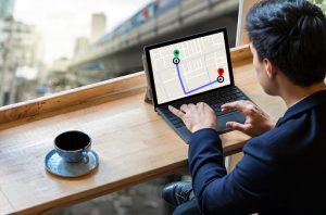
Map-Based Task Management
In TraXion, tasks aren't just listed — they're plotted. Every task has a geographic footprint, whether it's a point (install a tower), a line (lay fiber along this route), or a polygon (survey this area). This spatial context means managers can assign work based on proximity, identify geographic bottlenecks, and understand progress in the most intuitive way possible: by looking at a map.
Real-Time Location Tracking
Every field resource — people, vehicles, equipment — has a real-time position on the project map. This isn't surveillance; it's operational intelligence. Know which crew is closest to an urgent task. Verify that survey teams are actually covering their assigned routes. Get alerts if a vehicle deviates from its planned path. Track your field resources in real time and get alerts if they deviate from the route.
Geospatial Analytics
When every data point has coordinates, analysis becomes spatial. Cluster analysis reveals where problems concentrate. Heat maps show productivity patterns across the project geography. Route optimization suggests the most efficient sequence for field operations. Geofence-based rules automate alerts and workflows based on physical boundaries.
The Location Dimension in Practice
Let's walk through how the location dimension transforms daily operations across different infrastructure verticals:
- Highways & Roads — View construction progress kilometer by kilometer. Compare actual chainage-wise progress against design. Identify sections where earthwork or paving is falling behind, and see why (terrain difficulty, right-of-way issues, resource gaps) by overlaying geographic context.
- Telecom Networks — Track fiber laying, splicing, and testing across the entire network topology. Visualize which network segments are live, under construction, or pending. Optimize crew deployment based on geographic proximity and task dependencies.
- Power Transmission & Distribution — Monitor tower foundation, erection, and stringing progress across the transmission line. Track material movement between staging areas and tower sites. Plan outage management by understanding geographic impact zones.
- Oil & Gas Pipelines — Visualize pipeline routing against terrain, environmental sensitivity zones, and right-of-way status. Track welding, hydrotesting, and commissioning progress along the pipeline route. Integrate IoT sensor data for real-time pipeline monitoring post-construction.
- Water & Irrigation — Monitor canal construction, pump house installation, and distribution network progress. Track water flow and pressure at various nodes post-construction. Manage maintenance activities based on geographic zones and asset locations.
From Spreadsheets to Spatial Intelligence
The shift from traditional project management to GIS-enabled management is analogous to the shift from paper maps to GPS navigation. The underlying information might be similar, but the way you interact with it — and the decisions it enables — are fundamentally different.
A spreadsheet tells you a task is 3 days behind schedule. A map shows you that task is in a flood-prone zone during monsoon season, the access road was washed out last week, and the nearest replacement crew is 80 kilometers away. Same data, radically different understanding.
Traxion simplifies the management of infrastructure projects large and small by enabling real-time, map-based monitoring of tasks, earned value, manpower, assets, inventory, schedule, milestones, and more.
The Third Dimension of Infrastructure
Time and cost have always been the two primary dimensions of project management. The Gantt chart tracks one; the budget tracks the other. But infrastructure projects demand a third dimension — location — because the physical world doesn't organize itself into neat rows and columns.
When you add location as a first-class dimension, every other aspect of project management becomes richer. Scheduling becomes route-aware. Cost estimation becomes terrain-sensitive. Resource allocation becomes proximity-optimized. Risk assessment becomes geography-informed.
This is the location dimension. And once you've managed a project with it, you'll never go back to managing without it.